


RED ROCK CANYON
$0.00
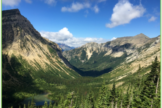
Red Rock Canyon is a great hike for the entire family. There is a popular trail around the perimeter of the canyon that is well maintained, has little elevation gain, and gives spectacular views of the colorful rock. On a hot day the creek in the canyon is a popular place for kids to cool off and play in the water. If you are looking for a slightly more adventurous hike you can venture up the canyon through the creek. A quick 1km side trip from the south point of the canyon trail takes you to the scenic Blakiston Falls Lookout Point. Check out the video of our adventure hiking Red Rock Canyon here!
Check out the ONLINE VERSION of our Red Rock Canyon Adventure Guide or click the button below for a downloadable PDF.
| Category: | Waterton |
|---|
Red Rock Canyon – Adventure Statistics
Time Required: 1-2 Hours
Location: 18 km from Waterton on Red Rock Parkway.
Distance: 3.5km round trip
Elevation Gain: 184m
Difficulty: 3/10 – Family friendly trail
Season: June to mid-October
Additional Requirements: N/A
Related Products
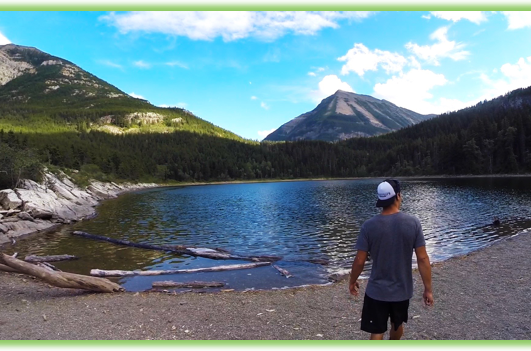
CRANDELL LAKE
Crandell Lake is a scenic trail walk that can be enjoyed by hikers of all abilities. The lake can be approached from either Red Rock Parkway or Akamina Parkway and is a great spot to enjoy an outdoor picnic. Check out the video of our adventure hiking to Crandell Lake here!
Check out the ONLINE VERSION of our Jello Crandell Lake Adventure Guide or click the button below for a downloadable PDF.
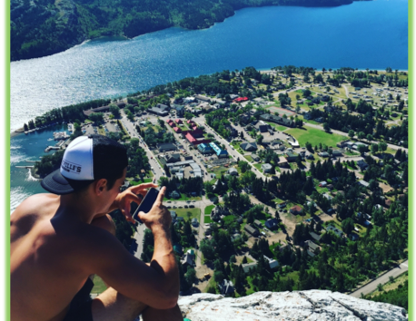
BEAR’S HUMP
Bear’s Hump is a short, moderately strenuous hike located on the outskirts of the town of Waterton. Once you summit the “hump” of the bear you are rewarded with outstanding views of the town of Waterton and lower and middle Waterton lakes. Check out the video of our adventure hiking Bear’s Hump here!
Check out the ONLINE VERSION of our Bear’s Hump Adventure Guide or click the button below for a downloadable PDF.
CRYPT LAKE
Crypt Lake is one of three hikes that make up Waterton’s Triple Crown and in 2014 National Geographic rated it as one of the worlds top 20 most thrilling trails! Highlights are spectacular waterfall views, a 60 ft. cave you will climb through and an exciting cable traverse along a cliff ledge. Check out the video of our adventure hiking to Crypt Lake here!
Check out the ONLINE VERSION of our Crypt Lake Adventure Guide or click the button below for a downloadable PDF.